
DON’T MISS: Canada’s historic wildfire season only halfway done: A checkpoint
The dew point here rarely climbs above 15°C during the summertime, but we could see dew point readings close to 20°C for some coastal communities by Monday. That’s the kind of uncomfortable humidity you’d expect to see on a sultry summer afternoon back east. So if you’re inclined to get some relief, head down to the beaches to get a cooler breeze.
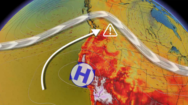
This setup is a tradeoff between simmering mugginess and searing heat. Folks along the immediate coast will have cooler temperatures but higher humidity, while communities farther inland will see hotter but less-muggy conditions.
Unfortunately, the Fraser Valley and Lower Mainland will be an exception to this pattern, as forecasters expect low-level moisture to pool in these areas, contributing to elevated humidex values.
Canada’s first 40°C of 2023 is almost here
Hot temperatures will arrive in earnest by Monday, ticking a few degrees warmer than what we saw on Sunday. These temperatures will be downright uncomfortable for most, and even dangerous heat for vulnerable populations throughout the region.
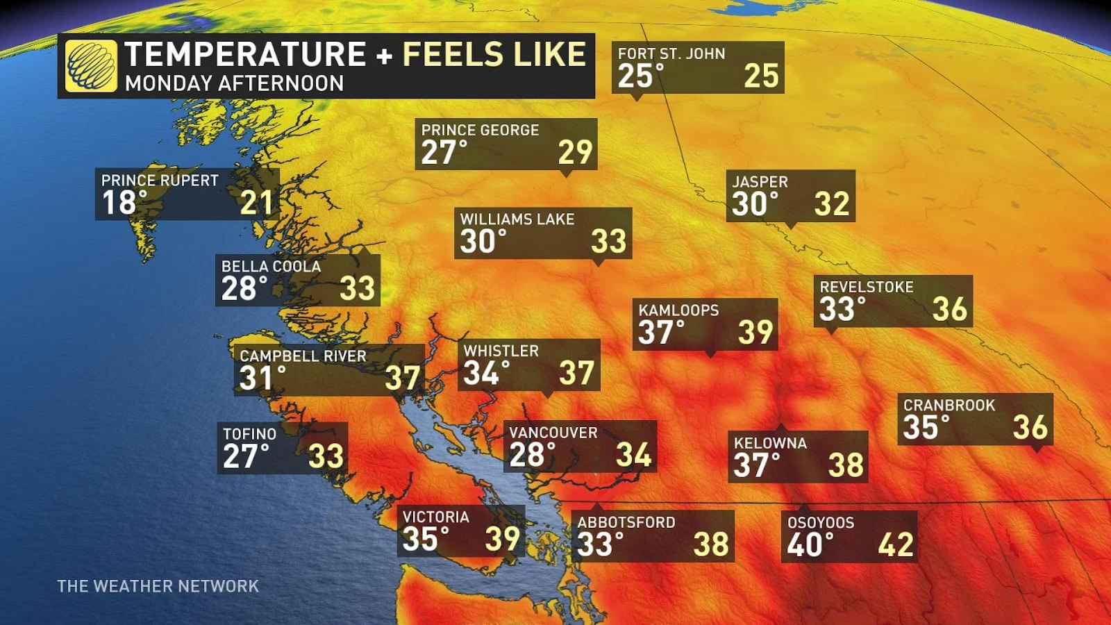
Daytime highs will climb into the upper 20s to near 30°C right along the coast, with the mid-30s likely as you travel inland up the Fraser.
All eyes are on Osoyoos and the southern Interior as temperatures are forecast to crest 40°C for the first time this summer across Canada. The warmest temperature recorded so far in Canada for 2023 goes to Etzicom, Alberta where the mercury reached 39.8°C back on July 25.