
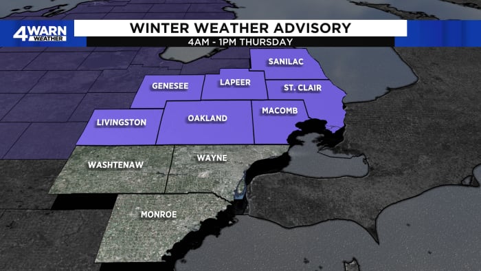
Thursday’s high in lower 40s; Friday’s high in upper 30s
4Warn Weather – Where you live and where you are headed are the two key questions regarding what kind of drive you will have on Thursday morning.
Here’s a breakdown:
-
6 a.m. – 8 a.m. Snow arrives from the West and overspreads most of SE Lower Michigan, with the heaviest snow in Northern Livingston, Oakland, and Macomb counties up into the thumb.
-
8 a.m.- 10 a.m. Temperatures warm, and we start to see a mix of snow, sleet, and freezing rain, especially south of I-696.
-
10 a.m. – 1 p.m. Snow continues north of M-59, and rain begins to make its way from the Ohio border up to the northern parts of Wayne County.
-
1 p.m.-3 p.m. rain over most of the area, moving out by the evening commute.
Snow rates will be high in this short-duration event, so accumulation looks likely north of I-94, with the highest amounts north.
Here’s a breakdown:
-
Around I-94: Trace to ½”
-
I-94 to I-96: ½” to 2″
-
I-96 to I-69: 2″-4″, maybe a touch more north.
The 4 Warn Weather Team continues to track the rain/snow line and will bring you updates.
Find the latest forecast from the 4Warn Weather team here
Remember to download the free 4Warn weather app — it’s easily one of the best in the nation. Just search your app store under WDIV and it’s right there available for both iPhones and Androids! Or click the appropriate link below.
Copyright 2024 by WDIV ClickOnDetroit – All rights reserved.