
It may officially be spring, but a large storm hit parts of New England with the heaviest snowfall of the season on Saturday, while Massachusetts dealt with flooding rainfall — with some parts experiencing an icy glaze along with the rain.Latest power outages | Interactive radar Nearly 4,000 utility customers in Massachusetts were without power as of Saturday night, while New Hampshire utilities reported more than 39,000 customers in the dark. Treacherous travel led to more than 100 crashes in the state of New Hampshire alone, as heavy wet snow and ice covered many of the roads.The Mount Washington Avalanche Center issued an Avalanche Warning for areas around and within the Presidential Range of the White Mountains through Sunday.While the storm has brought significant fresh snowfall, it has also created dangerous avalanche conditions that are expected to last throughout the weekend.Tuckerman Ravine, Huntington Ravine, Gulf of Slides, Great Gulf, Ammonoosuc Ravine, and other open steep slopes will be prone to this avalanche danger.Here’s a look at rainfall totals in Massachusetts, and snowfall totals over 10 inches from Vermont and New Hampshire. Rainfall totals across Massachusetts:(As of 9 p.m. Saturday)Westfield – 2.5″Orange – 2.26″Pittsfield – 2.26″Norwood – 2.16″Worcester – 1.9″Bedford – 1.89″Lawrence – 1.89″North Adams – 1.86″Boston – 1.78″Fitchburg – 1.76″Taunton – 1.75″Plymouth – 1.7″Beverly – 1.66″New Bedford – 1.33″Snowfall totals across New Hampshire: Claremont – 14.5″Lebanon – 14″Bristol – 13.5″Ellsworth – 13″Hanover – 12.5″Conway – 12.1″Grantham – 12″Lisbon – 12″Albany – 11″Bradford – 10.5″Warner – 10″Video below: Part of Interstate 93 closed amid multiple crashes Snowfall totals across Vermont: Landgrove – 24.5″Windsor – 23″Ludlow – 22″Woodstock – 21″White River Junction – 20″Shrewsbury – 19.3″North Hartland – 19″Pittsford – 19″South Ryegate – 19″Ascutney – 18″Clarendon – 18″Norwich – 18″Strafford – 18″West Fairlee Center – 18″West Pawlet – 18″Danby – 17.5″Weston – 17.5″Belmont – 17″Pomfret – 17″Quechee – 17″West Windsor – 17″Rutland – 16.8″West Norwich – 16.4″Randolph – 16″South Royalton – 16″Stockbridge – 16″Taftsville – 16″Andover – 16″Sharon – 15.8″Bradford – 15″Rochester – 15″Proctorsville- 15″East Bethel – 15″Fayston – 15″Waterbury – 12″Video below: Communities buried under more than a foot of snow in spring storm
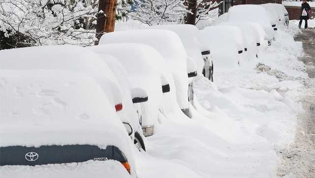
It may officially be spring, but a large storm hit parts of New England with the heaviest snowfall of the season on Saturday, while Massachusetts dealt with flooding rainfall — with some parts experiencing an icy glaze along with the rain.
Latest power outages | Interactive radar
Nearly 4,000 utility customers in Massachusetts were without power as of Saturday night, while New Hampshire utilities reported more than 39,000 customers in the dark.
Treacherous travel led to more than 100 crashes in the state of New Hampshire alone, as heavy wet snow and ice covered many of the roads.
The Mount Washington Avalanche Center issued an Avalanche Warning for areas around and within the Presidential Range of the White Mountains through Sunday.
While the storm has brought significant fresh snowfall, it has also created dangerous avalanche conditions that are expected to last throughout the weekend.
Tuckerman Ravine, Huntington Ravine, Gulf of Slides, Great Gulf, Ammonoosuc Ravine, and other open steep slopes will be prone to this avalanche danger.
Here’s a look at rainfall totals in Massachusetts, and snowfall totals over 10 inches from Vermont and New Hampshire.
Rainfall totals across Massachusetts:
(As of 9 p.m. Saturday)
- Westfield – 2.5″
- Orange – 2.26″
- Pittsfield – 2.26″
- Norwood – 2.16″
- Worcester – 1.9″
- Bedford – 1.89″
- Lawrence – 1.89″
- North Adams – 1.86″
- Boston – 1.78″
- Fitchburg – 1.76″
- Taunton – 1.75″
- Plymouth – 1.7″
- Beverly – 1.66″
- New Bedford – 1.33″
Snowfall totals across New Hampshire:
- Claremont – 14.5″
- Lebanon – 14″
- Bristol – 13.5″
- Ellsworth – 13″
- Hanover – 12.5″
- Conway – 12.1″
- Grantham – 12″
- Lisbon – 12″
- Albany – 11″
- Bradford – 10.5″
- Warner – 10″
Video below: Part of Interstate 93 closed amid multiple crashes
Snowfall totals across Vermont:
- Landgrove – 24.5″
- Windsor – 23″
- Ludlow – 22″
- Woodstock – 21″
- White River Junction – 20″
- Shrewsbury – 19.3″
- North Hartland – 19″
- Pittsford – 19″
- South Ryegate – 19″
- Ascutney – 18″
- Clarendon – 18″
- Norwich – 18″
- Strafford – 18″
- West Fairlee Center – 18″
- West Pawlet – 18″
- Danby – 17.5″
- Weston – 17.5″
- Belmont – 17″
- Pomfret – 17″
- Quechee – 17″
- West Windsor – 17″
- Rutland – 16.8″
- West Norwich – 16.4″
- Randolph – 16″
- South Royalton – 16″
- Stockbridge – 16″
- Taftsville – 16″
- Andover – 16″
- Sharon – 15.8″
- Bradford – 15″
- Rochester – 15″
- Proctorsville- 15″
- East Bethel – 15″
- Fayston – 15″
- Waterbury – 12″
Video below: Communities buried under more than a foot of snow in spring storm