
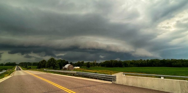

We will see a round of morning showers, but the environment picks up steam into the afternoon and evening hours. Severe storms are possible along the Highway 401 corridor east of Toronto heading all the way into Ottawa. Additionally, this will be possible on Highway 400 north, cottage country, Algonquin and all the way into Sudbury.
This widespread risk will affect many routes with large hail, up to golf ball-sized, and heavy downpours being the primary hazards.

Forecasters are closely watching a potent environment around the National Capital Region and eastern Ontario, spanning into southern Quebec, where one or two tornadoes may also be in the cards. Supercells are possible around the 4-7 p.m. hours when instability and thunderstorm energy are the highest, triggered by a cold front cutting through the region.

Confidence: High for severe thunderstorm activity, lower for tornadoes and exact timing of supercells
Keep your electronics charged and have a safety plan in place as weather watches and warnings update throughout the day. Expect to drive slowly and leave extra time if a thunderstorm pops up along your route.
WATCH: Nickel, golf ball, baseball; what these hail sizes mean for damage
Camping this long weekend? Check out The Weather Network’s Camping Guide before heading out!
Prepare
Make sure to keep up-to-date on your local forecast information and alerts. If you are outdoors in an area with a severe weather threat, make sure you have a safety plan in place in case you need to get to shelter.