A strong storm is pushing through New Hampshire on Sunday morning, bringing northern snow, heavy rain and the threat for coastal flooding.The National Weather Service has posted a winter storm warning for portions of Grafton, Carroll and Coos counties through late Sunday night. A flood watch is posted for portions of Carroll, Merrimack, Belknap, Strafford, Hillsborough and Rockingham counties for Sunday. Meanwhile, a coastal flood warning is in effect at the coastline. >> National Weather Service alerts and bulletins PRECIPITATION TYPES: WET SNOW, WINTRY MIX, RAIN The precipitation arrived late Saturday night and continued through early Sunday morning as snow for northern spots and heavy rain for central and southern areas.>> Interactive RadarMore than six inches of snow is expected in parts of the Mt. Washington Valley, and over a foot is likely in the heart of the White Mountains. About 4 to 6 inches of snow will fall in the western White Mountains and through the Lake Sunapee Region. Much smaller totals are expected in the Lakes Region and points south. For southern areas, it looks to be all rain. There is the potential for 1-2″ of rainfall, leading to ponding on roads and poor drainage flooding.The heaviest rain will taper to showers on Sunday morning. It will dry out for many by Sunday afternoon, with highs in the 40s.OTHER IMPACTS: COASTAL FLOODING, OUTAGESThe coastal flood warning is in effect for the coastline from 10 a.m. through 3 p.m.>> Hour-by-hour timelineAlong the coastline, we’ll need to monitor a high tide at midday Sunday. Moderate coastal flooding is expected along Route 1A and Ocean Boulevard in Hampton and Seabrook.Some scattered power outages are possible, especially in western and northern areas of the state where the most snow falls.LOOKING AHEADOn Monday, lingering snow showers in the mountains and perhaps a stray flurry in the southern part of the state are possible. Otherwise, it will be cooler and breezy, with highs around 40. A milder stretch develops later in the week. Be weather-aware! Download the WMUR app for Apple or Android devices and turn on push notifications. You can choose to receive weather alerts for your geolocation and/or up to three ZIP codes. In addition, you can receive word when precipitation is coming to your area.Get storm coverage through the free Very Local app on your smart TV.Follow the Storm Watch 9 team on social media:Mike Haddad: Facebook | XKevin Skarupa: Facebook | XHayley LaPoint: Facebook | XJacqueline Thomas: Facebook | XMatt Hoenig: Facebook | X
A strong storm is pushing through New Hampshire on Sunday morning, bringing northern snow, heavy rain and the threat for coastal flooding.
The National Weather Service has posted a winter storm warning for portions of Grafton, Carroll and Coos counties through late Sunday night. A flood watch is posted for portions of Carroll, Merrimack, Belknap, Strafford, Hillsborough and Rockingham counties for Sunday.
Meanwhile, a coastal flood warning is in effect at the coastline.
>> National Weather Service alerts and bulletins
PRECIPITATION TYPES: WET SNOW, WINTRY MIX, RAIN
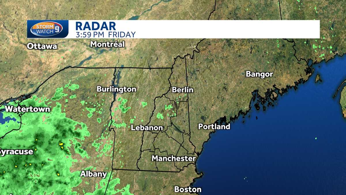
The precipitation arrived late Saturday night and continued through early Sunday morning as snow for northern spots and heavy rain for central and southern areas.
>> Interactive Radar
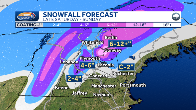
More than six inches of snow is expected in parts of the Mt. Washington Valley, and over a foot is likely in the heart of the White Mountains. About 4 to 6 inches of snow will fall in the western White Mountains and through the Lake Sunapee Region. Much smaller totals are expected in the Lakes Region and points south.
For southern areas, it looks to be all rain. There is the potential for 1-2″ of rainfall, leading to ponding on roads and poor drainage flooding.
The heaviest rain will taper to showers on Sunday morning. It will dry out for many by Sunday afternoon, with highs in the 40s.
OTHER IMPACTS: COASTAL FLOODING, OUTAGES
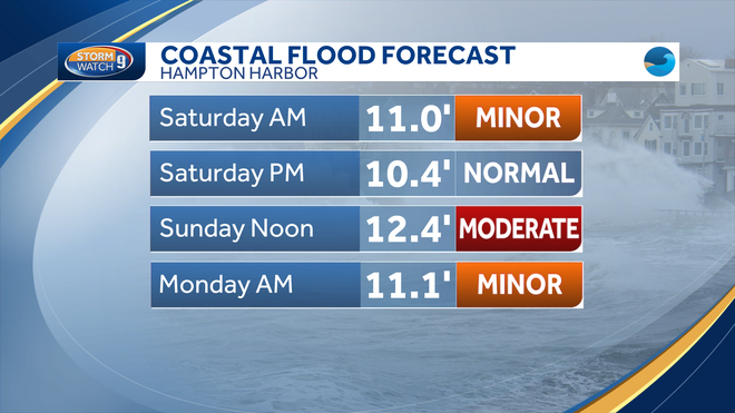
The coastal flood warning is in effect for the coastline from 10 a.m. through 3 p.m.
>> Hour-by-hour timeline
Along the coastline, we’ll need to monitor a high tide at midday Sunday. Moderate coastal flooding is expected along Route 1A and Ocean Boulevard in Hampton and Seabrook.
Some scattered power outages are possible, especially in western and northern areas of the state where the most snow falls.
LOOKING AHEAD
On Monday, lingering snow showers in the mountains and perhaps a stray flurry in the southern part of the state are possible. Otherwise, it will be cooler and breezy, with highs around 40. A milder stretch develops later in the week.
Be weather-aware! Download the WMUR app for Apple or Android devices and turn on push notifications. You can choose to receive weather alerts for your geolocation and/or up to three ZIP codes. In addition, you can receive word when precipitation is coming to your area.
Get storm coverage through the free Very Local app on your smart TV.
Follow the Storm Watch 9 team on social media:


