
An April nor’easter is headed our way, expected to bring rain, wind and plowable snow to parts of Massachusetts and New England.StormTeam 5 has labeled both Wednesday and Thursday Impact Weather days. “When the storm moves in, it has wind-driven rain and the snow,” said StormTeam 5 meteorologist Mike Wankum. “The area that’s most likely to see the snow is the high-elevation area off to the north and west.” The system will begin to move in with rain showers Tuesday night and there will be a slight break before more rain starts falling Wednesday morning.”It’s just cold enough Wednesday morning that we might get a little bit of a wintry mix-up around Route 2. Then, we get deeper into the storm, and it starts pull colder air in,” Wankum said. “Anything south of the Massachusetts Turnpike is going to be all rain.”Cold air will continue to try and drive further south Wednesday night, creating the potential for more snow in northern and western areas of Massachusetts Thursday morning.”Unless you have elevation, the temperatures are so marginal, the ground is so warm that most of us are going to be dealing with rain,” Wankum said. “As far as snow is concerned, with elevation you might get one to three inches up in the north. The Berkshires is probably the most likely spot we’ll get some plowable snow.”There’s a chance for power outages with this storm.The nor’easter is also expected to bring strong wind gusts, up to 50 mph, along the coastline, creating a chance for power outages.There will also be a chance of moderate coastal flooding during the storm.”I’m most concerned with that high tide on Thursday morning because the winds are still going to be strong out there and we do have a surge coming in with this storm,” Wankum said.The storm will slowly pull away on Friday, so it may stay a little unsettled into early Saturday before things dry out for the weekend.
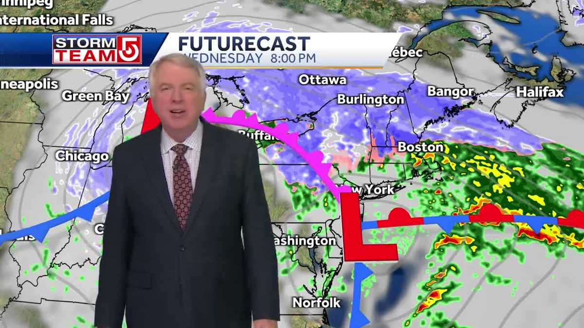
An April nor’easter is headed our way, expected to bring rain, wind and plowable snow to parts of Massachusetts and New England.
StormTeam 5 has labeled both Wednesday and Thursday Impact Weather days.
“When the storm moves in, it has wind-driven rain and the snow,” said StormTeam 5 meteorologist Mike Wankum. “The area that’s most likely to see the snow is the high-elevation area off to the north and west.”
The system will begin to move in with rain showers Tuesday night and there will be a slight break before more rain starts falling Wednesday morning.
“It’s just cold enough Wednesday morning that we might get a little bit of a wintry mix-up around Route 2. Then, we get deeper into the storm, and it starts pull colder air in,” Wankum said. “Anything south of the Massachusetts Turnpike is going to be all rain.”
Cold air will continue to try and drive further south Wednesday night, creating the potential for more snow in northern and western areas of Massachusetts Thursday morning.
“Unless you have elevation, the temperatures are so marginal, the ground is so warm that most of us are going to be dealing with rain,” Wankum said. “As far as snow is concerned, with elevation you might get one to three inches up in the north. The Berkshires is probably the most likely spot we’ll get some plowable snow.”
There’s a chance for power outages with this storm.
The nor’easter is also expected to bring strong wind gusts, up to 50 mph, along the coastline, creating a chance for power outages.
There will also be a chance of moderate coastal flooding during the storm.
“I’m most concerned with that high tide on Thursday morning because the winds are still going to be strong out there and we do have a surge coming in with this storm,” Wankum said.
The storm will slowly pull away on Friday, so it may stay a little unsettled into early Saturday before things dry out for the weekend.