
Published on Oct. 31, 2023, 2:49 PM
Eyes are on a mid-week system that threatens a more widespread snow over Atlantic Canada, along with strong winds, which could make for difficult travel and whiteout conditions
After the first taste of the winter season with a shot or two of snowfall across parts of Atlantic Canada on Monday, eyes are now on another system for mid-week, one that threatens a more widespread snow.
This will be the first snowfall of the season for parts of southern Nova Scotia, including Halifax, this time around.
MUST SEE: Warm or wintry? Halloween weekend holds a mixed bag for Canada
Drivers are being urged to plan for difficult winter travel, especially with this likely being the first dose for many motorists.
Wednesday
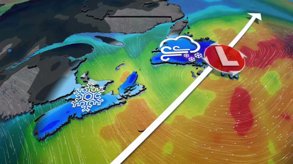
Low pressure will develop over the Atlantic and rapidly intensify as it tracks south of the Maritimes on Wednesday, then heading towards the Avalon Peninsula Wednesday night and into Thursday. This will put Nova Scotia and central Newfoundland in the crosshairs for accumulating wet snowfall and breezy conditions.
This forecast is naturally going to be in flux as temperatures hover around the freezing mark, and small wobbles in the track will make all the difference.

Nova Scotia is up first. By Wednesday morning, snowfall creeps into the southwest, building into Halifax and east through the day. Immediate shorelines may see a rain snow mix for periods of time, limiting accumulations there. But further inland, and at higher elevations, there’s a better chance for a white coating on the grass, with up to 5+ cm possible.