
Tropical Storm Ophelia has strengthened after it formed off the Atlantic coast Friday afternoon, threatening to bring heavy rain, storm surges and strong winds to the East Coast this weekend, the National Hurricane Center said.
As it moves towards the Mid-Atlantic region, it is forecast to make landfall in North Carolina early Saturday. Its impact is forecast to be strongest in parts of North Carolina and Virginia, with the potential of “life-threatening flash flooding.”
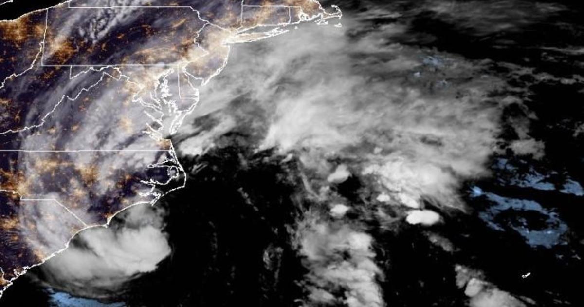
Ophelia had maximum sustained winds of 70 mph and was moving at 13 mph, according to a late Friday night advisory from the Miami-based center. The storm was centered about 70 miles southeast of Cape Fear, North Carolina.
On Saturday and Sunday the center of Ophelia was forecast to move across eastern North Carolina, southeastern Virginia and the Delmarva Peninsula, which includes portions of Maryland and Delaware. It is expected to weaken after it makes landfall, the hurricane center said.
The governors of North Carolina, Virginia and Maryland declared a state of emergency ahead of Ophelia’s arrival. Some schools closed early as communities prepared for the storm’s arrival, and several weekend events were canceled.
“We are expecting an extended period of strong winds, heavy rainfall, and elevated tides,” Maryland Gov. Wes Moore said in a Friday evening statement.
National Hurricane Center
A hurricane watch was in effect along an approximately 130-mile stretch of the North Carolina coastline between Surf City north to the Ocracoke Inlet.
Some areas of eastern North Caroline and southeast Virginia could get up to 7 inches of rain, forecasters said. Southern New York and southern New England could see anywhere from 1 to 3 inches of rain into Monday.
Storm surge warnings were in effect for several areas, with surges anywhere between 1 to 6 feet forecast for parts of North Carolina, Virginia, New Jersey and Delaware, the hurricane center reported.
NOAA/NESDIS/STAR
A tropical storm warning is in effect from Cape Fear, North Carolina, to Fenwick Island, Delaware. It also includes the Chesapeake Bay south of North Beach, tidal Potomac south of Cobb Island and Albemarle and Pamlico Sounds.
Ophelia affected water taxis Friday in Annapolis, where driver Scott Bierman said service would end at 6 p.m. and close Saturday.
“We don’t operate when it’s going to endanger passengers and or damage vessels,” Bierman said.
In Washington, the Nationals baseball team postponed its Saturday game until Sunday.
North Carolina Emergency Management warned large swells from distant Hurricane Nigel also would reach the state’s coast on Thursday, boosting the rip current risk. The combination of those swells and the low-pressure system could mean additional ocean overwash, beach erosion and coastal flooding.
Virginia Gov. Glenn Youngkin said the state’s Emergency Support Team will be activated until the storm passes.
“As this storm has organized and strengthened, it’s becoming clear based on the latest forecasts that impacts to the commonwealth are likely,” said Youngkin. “We want to ensure that all communities, particularly those with the greatest anticipated impact, have the resources they need to respond and recover from the effects of this storm. Since this storm has the potential to have a range of impacts across numerous localities in the commonwealth, I encourage all Virginians and visitors to keep up with the latest forecast for their area from a trusted source, make a plan, and have their emergency kits ready.”
The Virginia Department of Emergency Management said on social media Thursday that officials are coordinating with local weather service offices to watch the system developing off the coast.
Meanwhile, Hurricane Nigel was downgraded to a post-tropical cyclone centered about 640 miles northwest of the Azores with maximum sustained winds of 70 mph. There were no associated coastal watches or warnings as the storm moved northeast at 37 mph, the hurricane center said in its final update on the system Friday morning.