
Updated on Oct. 24, 2023, 5:11 PM
Just like that, Alberta saw a taste of winter with its first significant snowfall making a mess of the roads
An early shot of wintry weather has arrived across parts of Western Canada this week, with much colder-than-normal temperatures and blasts of heavy snow. A sharp trough dug in, replacing the warm October air that was felt in Alberta just last week.
Temperatures will even be colder than “normal” for January in the Calgary area, with highs of just -6°C to -7°C for mid- and late week. A few spots in southern and central Alberta will likely dip to below -20°C Wednesday and Thursday night, as a band of Arctic air settles in from northern British Columbia.
SNEAK PEEK: What El Niño means for Canada’s upcoming winter season
Because of that flood of Arctic air, the season’s first significant snowfall has also taken shape.
Snowfall warnings remained in place early Tuesday across the south, with as much as 25 cm possible in the hardest-hit areas by the time all is said and done. Between 15-20+ cm of snow had already been reported in the Calgary area before sunrise on Tuesday, with 19 cm piled up in Cochrane. Snowfall amounts may vary significantly, as some of the snow will melt on contact with the warm ground. The highest snowfall amounts are expected to be over western portions of the province.
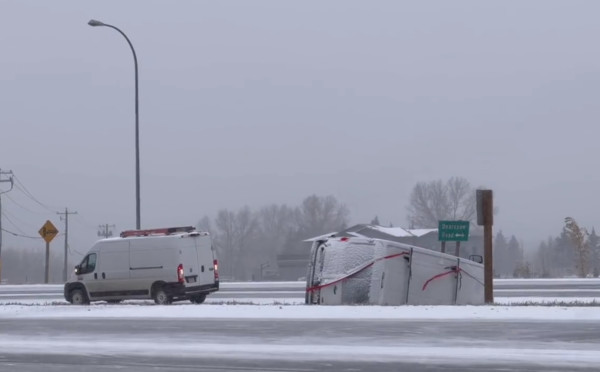
The snow will begin to taper through the day on Tuesday, but not without leaving a mark on the region first. Road conditions deteriorated quickly as the snow picked up on Monday, testing drivers as they dealt with the first taste of winter travel.
According to police, a school bus carrying 12 people rolled over on Highway 2A just north of Didsbury on Monday, with road conditions believed to be a factor in the collision.